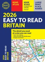
2025 Philip's Big Easy to Read Britain Road Atlas
(A3 Paperback)
(Author) Philip's MapsWith the detail you need at a size you can read, the latest edition of 2025 Philip's Big Easy to Read Road Atlas of Britain is super-clear, super-sized and bang up-to-date in a large paperback format. · Huge 1:150,000 scale (approx 2.4 miles to 1 inch) · Large super-sized pages (A3) · Large print place names, and large scale maps · 88 detailed town plans for easy navigation · Clear road colours, which are easier to read in the dark · Thousands of attractions clearly mapped · Special route planner section for arranging the best trips · Large print approach maps for all major cities · Durable paperback format At last, a road atlas that everyone can read easily in or out of the car, no matter what the conditions. Restricted motorway information, a distance chart, and clearly labelled places of interest are just some of the features within this bestselling road atlas of Britain. Whether it's getting dark, or you just can't find your glasses, 2025 Philip's Big Easy to Read Road Atlas of Britain is the ultimate road companion.
Philip's Maps
Philip's Maps is a renowned cartographer known for creating detailed and accurate maps of various regions around the world. Their most notable works include maps of cities, countries, and continents, which are highly regarded for their precision and clarity. Philip's Maps has made significant contributions to the field of geography and navigation through their meticulous attention to detail and dedication to producing high-quality maps. Their work has had a lasting impact on the world of cartography and has become an invaluable resource for travelers, researchers, and historians. One of their most famous works is the World Atlas, which remains a staple in libraries and educational institutions worldwide.
Other related
Philip's RGS World Atlas (A4)
with Global Cities, Facts and Flags

2026 Philip's Big Road Atlas of Britain & Ireland
(A3 Paperback)
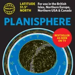
Philip's Planisphere (Latitude 51.5 North)
For use in Britain and Ireland, Northern Europe, Northern USA and Canada